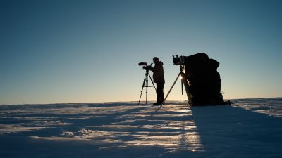
Traversing Antarctic Crevasses
On the 14th of December, five scientists, Alain Hubert and field guide Christophe Berclaz returned to Princess Elisabeth after spending 11 days in the field, navigating treacherous crevasses The expedition was dedicated to servicing instruments installed last year and to take measurements for the IceCon and Be:Wise projects.
-
It takes 18 hours to drive down to Roi Baudouin iceshelf from Princess Elisabeth Antarctica polar research station.
© International Polar Foundation
-
First camp on the ice shelf for the scientists. IceCon aims to gain a better understanding of the rate of the loss of ice – now and in the past - from the Antarctic ice sheet in the Dronning Maud Land area. Be:Wise aims to improve understanding of ice-shelf flow dynamics by focusing on the buttressing role of ice rises and pinning points – small offshore mountains which support Antarctic ice shelves from underneath.
© International Polar Foundation
-
The beacon we placed to measure GPS position last year, was seriously damaged by the strong winds of the winter.
© International Polar Foundation
-
First operation was to install the reference station on Polarhav ice rise, which will be used for the entire survey.
© International Polar Foundation
-
Field guide Christophe Berclaz inspecting a crevasse.
© International Polar Foundation
-
The ice shelf is full with crevasses in the zone where scientists are working.
© International Polar Foundation
-
The bridge of this crevasse is 2m thick
© International Polar Foundation
-
The device behind the skidoo is a radar which help us to detect crevasses
© International Polar Foundation
-
In order to secure the scientists operations, field guides spent more than 14 hours surveying the ice shelf and sea ice
© International Polar Foundation
-
An Antarctic crevasse.
© International Polar Foundation
-
An Antarctic crevasse.
© International Polar Foundation
-
An Antarctic crevasse.
© International Polar Foundation
-
Small crevasse revealed by the passage of a skidoo, curved lines are indicating to the drivers their position.
© International Polar Foundation
-
Surveying Sea ice with a skidoo.
© International Polar Foundation
-
Glaciologist Reinhard Drews putting in place an antenna in order to do radar measurements of the deformation of the ice shelf for his Be:Wise project
© International Polar Foundation
-
Lionel Favier and Reinhard Drews adjusting their device in order to take measurements with their ground penetrating radar.
© International Polar Foundation
-
Expedition leader Alain Hubert is installing a new grid of bars for taking GPS measurements.
© International Polar Foundation
-
Christophe Berclaz, displaying the first fresh bread ever baked in our kitchen caboose.
© International Polar Foundation
-
Expedition leader Alain Hubert looking at the radar to detect dangerous crevasses.
© International Polar Foundation
-
Scientist Nicolas Bergeot and field guide Christophe Berklaz are digging out the solar panel and windturbines of the GPS station on Derwael ice rise which was buried under one metre of snow since it was installed last year.
© International Polar Foundation
-
We are lucky to have the tractor to help us lift out the 400kg battery pack.
© International Polar Foundation
-
Reinstalling the new GPS station during a whiteout.
© International Polar Foundation
-
Basecamp at Derwael ice rise.
© International Polar Foundation


